Sunday, July 28, 2013

Goshute Mountains, NE Nevada

Just SW of Wendover is a north-south range about 25 miles long, one of many, many such ranges in Nevada. 

The Goshute range is probably most famous (recently) for being the location where volunteers from Hawkwatch International assemble in the late summer / early fall to count raptors flying south for the winter.  Because of the Great Salt Lake Desert, ranges like the Goshutes provide a great location to spot birds of prey migrating, because the raptors will funnel into routes that provide opportunities to find food, they "surf" from range to range, on their trip south into Mexico and Central America.

During the summer monsoon season in Utah - which really means, just more humid air from the Pacific ocean that results in clouds and some thunderstorms, not the drenching rainstorms like they have in Asia - I took my trusty Toyota out to the Goshutes and then climbed the 1500 vertical feet to the top.  As always, a trip very worth the gas money, time, and wear & tear on my hiking boots.

Speaking of raptors, here's a Golden Eagle perched on a rock before I started up into the Goshute range:


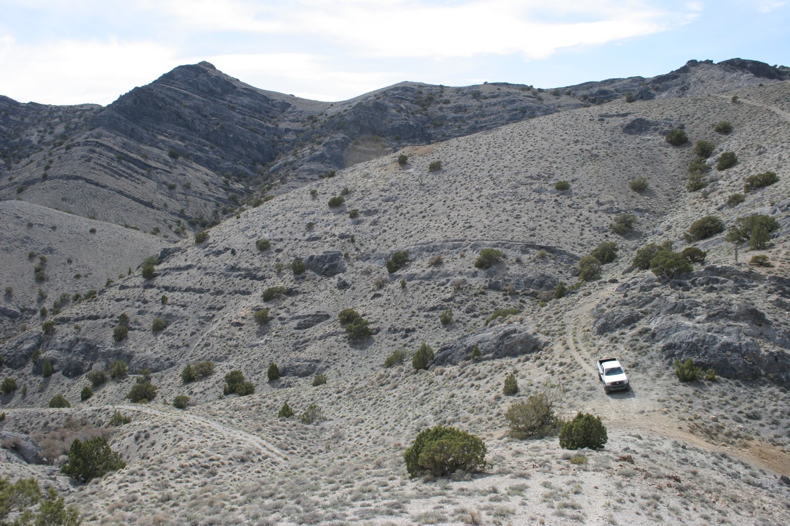
Maybe not a full drenching, but plenty of Great Basin monsoon precipitation, which might mean some drizzle, but could also mean "dry lightning", which can start a range fire and move on, not helping to put out the fire with significant amounts of rain.  (Looking north in the Goshutes on the way up):


Once up on top, I saw the Hawkwatch camp location and the sun broke out, with some nice vistas as a result.  Here's a pine tree near the top that's seen better days, perhaps a victim of lightning: 


Looking south from the Goshute Peak summit, some pine forests, a small section of Antelope Valley, and the south end of the Goshutes in the distance:


Looking SE from the summit, with Dutch Mountain at the very north end of the Deepcreek Mountains in the distance:


Looking NE, with a nice little mountain meadow in the foreground, and Pilot Peak, NV on the left, Wendover and the western edge of the GSL desert in the middle, and the Silver Island mountains in the distance in center and toward the right:


Looking north, Pilot Peak looks like a volcano:


"Taco", my trusty Toyota Tacoma, is a little speck, even with 300mm of lens:


Another shot of Pilot Peak on the way out:


Saturday, June 1, 2013

Grouse Creek Mountains, NW Utah

West-Northwest of the Great Salt Lake about 80 miles are the Grouse Creek Mountains, which run north & south about 25 miles.  They top out around 9000 feet and don't have a lot of foliage, but there is some.  The view from the top of the Grouse Creeks is, not surprisingly, pretty nice.  (This is a recurring theme in my trips to the desert.:) )

From near the top of Inghram Peak, looking SE with the Newfoundland Mountains in the distance:


Near the top of Inghram Peak, there are lots & lots of these little circular cacti, at about the 8500-9000 foot level.  I'm not an expert in cactus, but I thought they were pretty cool:


Benchmark, Inghram Peak, but with no elevation stamped:
 
 
Looking south from the summit, with Pilot Peak on the right, and the Silver Island Mountains distance in the middle.


Looking NE, the Raftriver Mountains run East-West, about 20 miles away:


There are some stands of pine in some of the west-facing canyons, and a few small creeks that supply the small community of Grouse Creek, Utah with water:


As sunset gets closer, some better lighting emerges.  Looking SE toward Desert Peak and the Newfoundland Mountains:


Sunday, April 14, 2013

Cedar Mountains Wilderness, Utah

About an hour west of SLC on I-80, past Grantsville, past Skull Valley, lies the Cedar Mountains, which form the last range going west before the expanse of the Great Salt Lake Desert.  The Cedar Mountains are quite arid, and remarkably undisturbed.  If you want solitude, they are an awesome resource, and it's heartening to know this range was designated as wilderness.


Yep, the ill-fated Donner Party went through this range on their
way to California, before getting really bogged down in the
salt flats trying to get to Pilot Peak, the nearest fresh water on
an 80 sprint across the GSL desert.


Looking SW toward the Deep Creek mountains, and the
Snake Valley, currently a controversial issue because
Las Vegas wants to take their already meager water supplies.


Looking NW toward the Newfoundland Mountains and Desert Peak.


From the top of the Cedar Mountains, looking east to Deseret Peak
 in the Stansbury Mountains.  See all that snow? 
That's why I'm not hiking the big peaks quite yet.  lol.


On the way to the summit.  Pretty easy hiking, a good workout at 7000+ feet.


The day was mostly cloudy, windy and cold, with a cold front dropping
the temperature about 20F during my hike, but the sun broke out
later to give me some nice shadow effects against the sparsely forested foothills.


Almost sunset, back down on the road on the west side of the range
some Cedar trees provide a nice foreground to their namesake mountain range.


A couple of Ferruginous Hawks trying to stay out the wind.


Cedar trees lined up in a row at sunset.


Saturday, April 6, 2013

Newfoundland Mountains, NW Utah

The Great Salt Lake desert is an expansive flat area of playa, mudflats, salt flats.  In the middle of this vast, uninhabited area is a small ranges called the Newfoundland Mountains.  This range is very isolated, though the hike to the top of Desert Peak is rewarding.

Crossing the railroad from Lakeside (about 25 miles of gravel
road, max speed about 35mph) you travel south and to hike
Desert Peak I went along the western "shore" of this range to
an old mining trail, and got up as high on the bench as I could.
Along the south ride of Desert Peak, looking
south along the eastern side of the range as it
extends like the tail of a scorpion.


Another shot looking south from Desert Peak


Looking north from Desert Peak.  There were rain squalls moving
through, and three prarie falcons above making a lot of racket.


Coming back down, as the day turned to dusk,
a view to the W-SW with Silver Island Mountains and
Pilot Peak behind.


Looking north down the western side of
the Newfoundlands, with the Grouse
Creek Mountains in the distance.


Last few moments of sunlight, looking toward
NW corner of Newfoundlands from mudflats.


Saturday, March 16, 2013

Hogup Mountains, NW Utah

East of the Great Salt Lake lies the major population centers of Utah, from Ogden to Provo, including Salt Lake City.

The area west of the Great Salt Lake is known to very few.  It is viewed by many as a vast wasteland, suitable for Air Force bombing practice, a railroad that traverses it, and a nuclear waste dump, along with Interstate 80 from SLC to Wendover, on its way to San Francisco.

Except there is more...

I've not fully explored the Hogup Range, which is on the western shore of the north end of the GSL, about 30 miles due west of the Spiral Jetty, for those who are familiar with this famous earth art, produced in 1970 by Robert Smithson.

The Hogup Range is noted for another, less famous landmark: the Hogup Cave, which was discovered as a long time seasonal hunting shelter for Native Americans, excavated by an Anthropology professor from the University of Oregon in the late 1960s.  Amazingly, this cave was shown to have been inhabited going back 8800 years, long before the days Jesus walked the earth, even before there was written language, anywhere on Earth.

So, as a warmup to longer, more strenuous hikes, and waiting patiently for snow levels to recede in other hiking areas, I embarked on a long ride to find Hogup Cave, and to hike to the top of the Hogup Range.


On the way north of I-80 toward Lakeside,
I saw a remarkably un-shy Antelope:


Travelling along the railroad west of the causeway,
the remnants of Governor Norm Bangerter's natural gas
 pumps that helped lower the Great Salt Lake in the early 80s:


Looking west from near Lakeside over the
Newfoundland Mountains to Pilot Peak, Nevada:


A real life mirage looking SW over the mudflat/saltflats
near the Air Force bombing range, the south end
 of the Newfoundland Mountains:


Hiking the Hogup Range, looking NW toward the Grouse Creek Mountains:


Near the top of the Hogups, looking east E-SE toward the Wasatch, you can see (from the bottom) the north side of the GSL, then the lake south of the railroad causeway, then Antelope Island, and the mountains behind Bountiful, UT beyond that, including Sessions Mountain, Pyramid Peak, Blacks Peak and Black Mountain on the south side of City Creek canyon.  About 70 miles as the crow flies.


Looking north over a hill in the Hogups toward
Bull Mountain and the east-west running Raft River
Mountains:


Looking south over the Hogup foothills toward Desert Peak.


SW view of the north end of Newfoundland Mountains


Hogup Cave is not easy to find. 
You really need to know where to look.
8800 years of archeological history.


SW view of the Newfoundland Mountains.


Dust devil across the playa looking at the Grouse Creek Mountains.


Monday, November 26, 2012

Best of the Rest from 2012

Some catchup photos from this season's hikes and other vacations:

Alpine Loop:


Antelope Island at Sunset:


Top of Mount Nebo, looking north:
 
 
Bryce Canyon:


Mount Olympus, from Parley's Canyon north side of mouth


Great Basin Rattlesnake


Looking north from Bountiful to Mount Ben Lomond, in the distance