Sunday, August 28, 2011

Raftriver Mountains, NW Utah

In the northwest corner of Utah, north of the Great Salt Lake, is an east-west range called the Raftriver mountains.  It's a unique part of Utah, because the northern slope of this range drains into the Snake River, which joins the Columbia River, and empties into the Pacific Ocean.  The southern slope of the Raftriver range produces several creeks, which empty into the Great Salt Lake, or otherwise dry up in the desert.
I approached this range from the north, traveling west of Snowville, UT about 35 miles, and then south and up into the Raftrivers.  Since my VW Jetta is not a great offroad vehicle, *wink*, to get to the top of this range I ended up hiking about 5 miles each way on established 4WD/ATV trails, gaining about 2500 feet in elevation.  It was worth it.

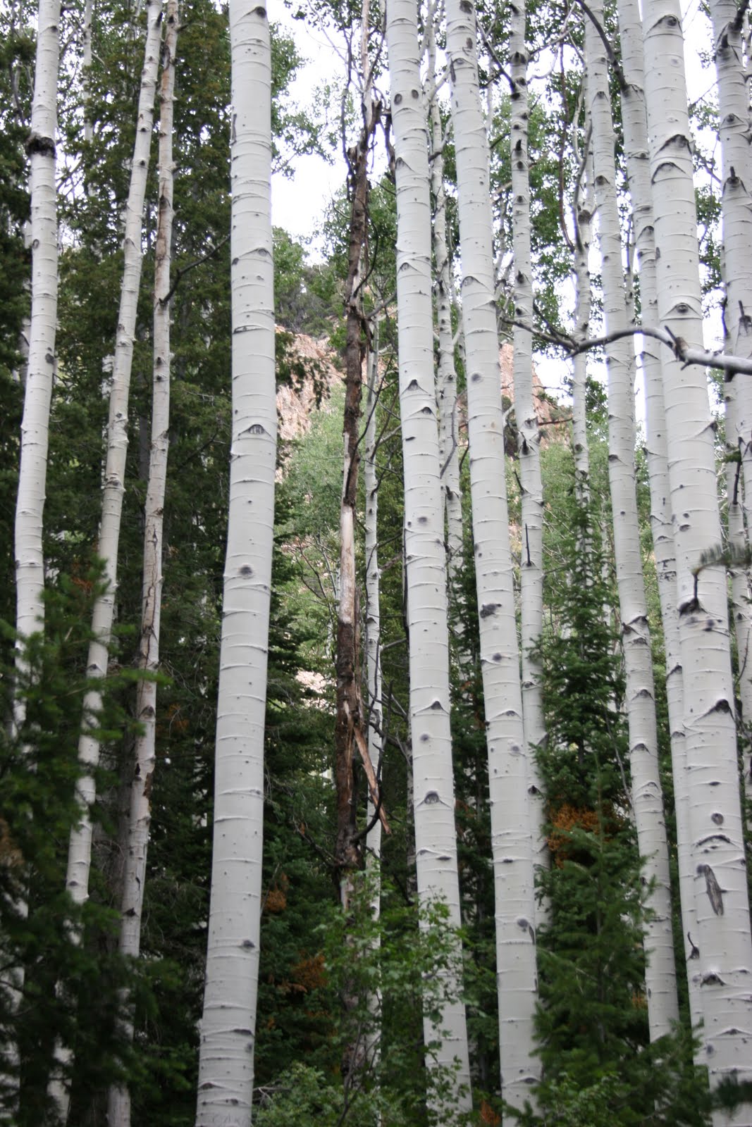
The northern slope of the Raftrivers has an impressive amount of conifer forests:


Looking NW into Idaho to an area called the City of Rocks, which is a popular location for rock climbers:
Looking north from the top ridge, toward a lower ridge, with Idaho in the background:
The top of the Raftrivers is about 9900 feet, but it is essentially an east-west ridgeline that is several miles long.  There was still some snow north of the highpoint in late August.

Looking just about directly south, to the Newfoundland Mountains, which is a north-south range about 50 miles away.  The Newfoundlands are pretty remote, with Desert Peak topping the range at about 7500 feet. 

To the southwest about 60 miles or so is Pilot Peak, NV, a landmark that you can see from numerous locations along the Wasatch and other Great Basin ranges in Utah & Nevada:

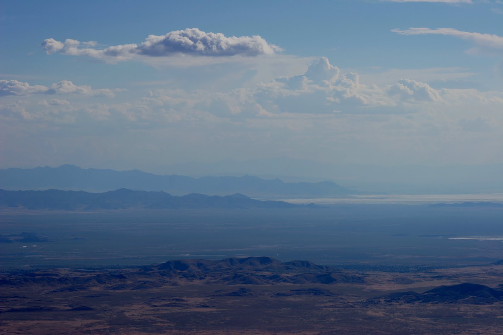
Southeast from the summit in the distance you can see the Wasatch at Willard, UT with Willard Peak on the left & Ben Lomond Peak to the right.  The Promontory Mountains are in the foreground, along with the northern tip of the Great Salt Lake:

Looking south down one of the short canyons that are north of the community of Park Valley, UT, the Hogup Mountains west of the Great Salt Lake are in the background:

Sunday, August 14, 2011

Deseret Peak

Deseret Peak is the highpoint in the Stansbury Mountains, which is the 2nd range west of Salt Lake going into the Great Basin.  Beautiful landscape, the top portion carved out by a glacier, with the Tooele Valley basin on the east, and Skull Valley just to the west, with the arid and lower Cedar Mountains beyond that, and the Great Salt Lake desert and salt flats beyond that.


I have to get a wildflower picture in here.  There are a ton of wildflowers this year, especially at higher elevations.


Plenty of stands of Aspen:


Looking back to the NE down South Willow Canyon, with the southern part of the Great Salt Lake and Antelope Island in the distance, as well as the Oquirrh Mountains on the right, and then Bountiful Peak and Francis Peak of the Wasatch in the distance:


Across the Tooele Valley to the northern portion of the Oquirrh Mountains, with the Davis Country portion of the Wasatch behind them:


It was about 3700 feet of vertical, reaching 11,031 at the peak, where the view was impressive.  I wish the day was a little clearer, but I could make out Mount Moriah in Nevada, about 115 miles to the southwest, as well as Gunsight Peak to the north, near Idaho, past Ben Lomond Peak and the Wellsville Mountains.  Pilot Peak in Nevada was fairly easily seen, across the salt flats and playa of the Great Salt Lake Desert, and I was able to see the Toano Mountains west of Pilot Peak, as well as the Goshute Mountains and Antelope Mountains in Nevada.  On a clearer day I'm pretty sure you could see Wheeler Peak at Great Basin National Park, which would be about 135 miles away.

Looking southwest, the south end of the Cedar Mountains, then Granite Mountain in the US Army Dugway Proving Ground, with the Deep Creek Mountains in the distance.


Still looking southwest, you can see the Fish Springs Range, and very faint, in the distance is Mt. Moriah.


Looking south, the Sheeprock Mountains are in the background, with the Canyon Mountains east of Delta, UT in the distance.


Looking east, over the top of Lowe Peak and Flat Top Peak at the top of the Oquirrh Mountains, you can see Mount Timpanogos in the background, which overlooks Provo, UT.


Sunday, August 7, 2011

Ben Lomond Peak, Northern Wasatch

Ben Lomond Peak is just north of Ogden, UT, rising to 9712 feet, some 5000+ feet above the valley floor.  I went on a late Sunday hike, starting at 4p, getting back home about midnight. 

The wild flowers were varied and abundant:


Approaching Ben Lomond from the northwest:

Looking south from the top toward Ogden:


Golden eagle riding the air currents below the summit, with North Ogden neighorhood in the background:


One of many Rocky Mountain Goats who were cautiously observant of the intruder with the camera:


It was a hazy day, probably from wildfires somewhere in the West.  But still you could see to Nevada.  Promontory Mountains, then Desert Peak from the Newfoundland Mountains, and Pilot Peak, NV in the distance, over 120 miles away.


Nightime falling on Ogden - gonna be a dark hike back down the mountain!

Lights of Salt Lake appearing in the distance, looking south:


Sunset, over the Raft River mountains to the north west, with the Promontory mountains in the foreground.

Sunday, July 31, 2011

Great Sand Dunes NP / Sangre de Cristo Mountains, Colorado

On a cross-country flight years ago I was scanning the landscape below and saw some incredible sand dunes.  Later locating the dunes later on a map as being near Alamosa, Colorado, this trip got stuffed away on the bucket list. 

I finally got to Alamosa, the San Luis Valley & Great Sand Dunes National Park this summer.

The San Luis Valley was settled by Mexican pioneers early in the 1800s, then was added to the U.S. as part of the Treaty of Hidalgo.  The valley is very high, between 7500 and 8000 feet, which makes the adjacent Sangre de Cristo ("Blood of Christ") mountains very high, between 12,000 and almost 14,000 feet.


Northern part of Sangre de Cristo range:

Sunday, July 17, 2011

Bountiful Peak - July 17, 2011

I feel a little guilty about this one, because there was really no hiking involved.  East of Bountiful, Utah is Skyline Drive, which is a dirt road that winds back & forth up the mountains east of Bountiful.  Actually, the name is a bit of a misnomer, because Bountiful Peak is actually just east of Farmington, Utah.

A very hot Sunday of 97F, which is the perfect conditions to get up in the mountains.  It was probably in the low to mid 70s on top, with a nice breeze.  Almost too cool for shorts.

Looking south from Bountiful Peak toward Grand View Peak:


Indian Paintbrush at 9300 feet elevation:


Looking south, at the bottom is Black Mountain east of Bountiful, then Mount Olympus, Lone Peak, and Twin Peaks in the distance:


South view, Sessions Mountain east of Bountiful, then Black Mountain, with Twin Peaks in the distance:


Bountiful Peak Geologic Survey benchmark, from 1950:


After a 9:00p sunset (Summer is just awesome!) on the way down I caught a nice view looking west, over Antelope Island and Frary Peak, with Nevada's Pilot Peak in the distance:

Friday, July 15, 2011

Oquirrh Mountains - Ophir Canyon July 15, 2011

The Oquirrh Mountains lie west of Salt Lake City and represent the first range in the Great Basin heading west.  The range is private property, which means access can be tricky.  I wanted to get to the top of the range, which is in the southern end, and scoped out the quickest ascent would probably involve taking Ophir Canyon as high as car allowed, then get out & hike it.  I didn't quite get to the top, ran out of time.  Next time maybe I'll just take the whole day off and do this hike the right way instead of sneaking out of work at 3:30p for a hour & a half drive to the trailhead.

Ophir is an old mining town on the SW corner of the Oquirrhs that is in remarkably good shape, and has not only a steady permanent population of folks who don't want anything to do with big city life, but there is also a (much larger than I remembered) summer population occupying camp sites.

Ophir City Hall:


The lighting wasn't the best and I really just wanted to get to my target peak, Lowe Peak, el 10,600, so I didn't take many pictures on the way up.  I was surprised at how much water was in Ophir Creek.  The snow up top is still melting, but this canyon is certainly bigger & wetter than many other canyons in the Great Basin.


A herd of Elk spotted me from a mile away and were very wary of the stranger with the red University of Utah shirt, and subsequently didn't let me get very close.   (No problem, just use a bigger lens):


I was stopped at the 9300 ft mark, maybe 1500 feet short of my goal, but the thought of hiking back down in the dark didn't appeal to me, so here's my highest shot.  (In the top right part of the picture you can see the Elk herd, keeping distance.)


On the way back down I went through extensive stands of Aspen, and naturally people have made a practice of carving their names & the date-year on the side of the tree.  There's really no way for a amateur like me to verify these dates, but a few of the signatures seemed to come from a different time in our nation's history altogether.  This one suggests a nice summer getaway, maybe a picnic, well before World War II.

Sunday, July 3, 2011

Pequop Mountains, Nevada

Third time is the charm!  I've been wanting to hike this range since last winter.  I took a trip in March to scout out different approaches, and got my truck stuck in the snow, had to hike out about 10 miles back to I-80.  We live in a skeptical society these days, and after about 200 vehicles passed me & my extended thumb, and with the temperatures dropping fast, I called the Nevada Highway Patrol and they graciously gave me a ride to Wendover, where my lovely wife picked me up at the Peppermill Casino.

In May and with snow levels quite a bit higher, I tried again, and this time I was about 15 miles east of Pequop (approximately 20 west of Wendover) and the old Ranger started vibrating and making a lot of noise.  Another call to my incredibly understanding and supportive wife, and we towed the truck 150 miles back to Bountiful.

Undeterred, I made the trip out to Pequop again yesterday, July 2, 2011.  This time I took the wife's RAV (yes, I'm a very lucky man). 

What an incredible day!  It was the day after the July 1st admittance of the University of Utah to the PAC-12 conference, a great time to reflect and finally conquer the Pequop range.  I took I-80 exit 365 and started south in the Independence Valley, looking to go up a canyon on the west side of the range about 15 miles south of the Interstate.

The Pequop range lies west of the Goshute range and Goshute valley, and east of the Humboldt range with Independence Valley lying in between, and Spruce Mountain rising up to the southwest.  Classic basin & range geography, high level of isolation (I didn't see another soul after I left the Interstate, on a Saturday).

I'm addicted to this land...

Looking south-southwest from near the South Pequop BM, toward Spruce mountain, with some playa in the valley:


Over the ridge looking southeast, toward the Goshute moutains, with just a glimpse of the Deepcreek Mountains in the distance:

Spruce Mountain, with wind blowing up some dust on the playa:

I saw at least a half dozen dust devils, a couple of them far bigger than any I've seen before.  This one is a few hundred feet high, in my estimation.  It had a well developed inner core, twisting well off the ground, with a larger ring of dust circling, as well:


Looking east from the summit, the Toano Mountains appear in the foreground, with Pilot Peak behind: