Sunday, October 2, 2011

SLC foothills

Salt Lake City is on the eastern edge of the Great Basin, with the Wasatch Mountains on the eastern edge of SLC being considered part of the Rocky Mountains, and the Salt Lake Valley as a classic basin in the Basin & Range topography.

In the northeast corner of the Salt Lake Valley is the University of Utah, with foothills of the Wasatch just east of the campus.

I hiked up a short canyon and then circled back to the west, climbing the foothill where the "U" on the hill is located.

Looking south over the foothills toward Lone Peak, a 11,000 foot peak SE of SLC:

The same view, with Mount Olympus in the background:

From on top of the foothill, looking west over the northern foothills, to the Great Salt Lake and Stansbury Island in the background:

The Salt Lake aiport control tower, with the Great Salt Lake and Stansbury Island:

Mount Olympus, with Lone Peak in the background:

The western flank of Mount Olympus, and Lone Peak.  If you look closely, you can see the small glacier on Lone Peak's northeastern exposure:

Draper Ridge, leading up to Lone Peak:

University of Utah Health Sciences Center, Mount Olympus:

 
U of U Health Sciences Center:

Saturday, September 24, 2011

Mount Moriah, eastern Nevada

This is another peak on my bucket list.  I hiked Wheeler Peak - which is south of Mt Moriah, also in the Snake Range - waaay back before it became part of Great Basin National Park.

Drove out to Ely, NV after work on Friday to get a good night's rest before talking on Mt Moriah, which proved to be a good idea, because this mountain is a real muthuh.  I took the "easy" route, driving north through Spring Valley from Highway 50 east of Ely.  After about 15 miles on dirt road, you take right and go eastbound on Forest Service road 469, which ascends rapidly on what amounts to foothill's on Mt. Moriah's western edge.  Once you get on top of the foothills, the vistas emerge in all directions.  Another 7 miles or so of driving on pretty rocky jeep trails gets you to the Big Canyon trailhead, which is a big headstart to the peak, compared to the eastern canyons, Hampton & Hendry.

Looking south along the western edge of the Snake Range, from Spring Valley:

Climbing up the western foothills of Mt. Moriah, looking west across Spring Valley to the Schell Creek Mountains, with Yelland (Dry) Lake in view:


Once on top of the foothills, looking south to Wheeler Peak in Great Basin National Park:


Big Canyon trailhead.  (It looks like the sign could use a little touchup work):


Mount Moriah, from the north.  Note the late summer / early fall snow around the peak.


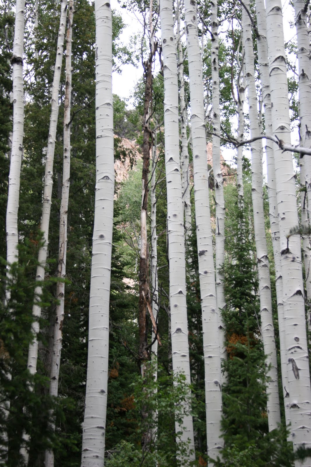
Much like Wheeler Peak, Mt. Moriah had significant erosion from glaciers in the last ice age, and Big Canyon is carved out of the north side of the mountain, with a lot of talus in a upper part of the canyon:


North of the Mt Moriah peak is maybe the most distinctive part of this mountain, "The Table", which is a remarkably flat area of maybe 300 or 400 hundred acres.  You could easily have a gigantic game of flag football or soccer, or lacrosse up here, except that it's at about 11,000 feet, which means you get out of breath very, very quickly.  Looking north over The Table, with the Deep Creek Mountains in Utah in the distance:


On the eastern flank of Mt Moriah, a Bristlecone Pine, which is one of the oldest species of plant life on the planet.  A researcher cut down a Bristlecone Pine on Wheeler Peak in the 60s, only to discover it was over 4400 years old.


Got the summit!!

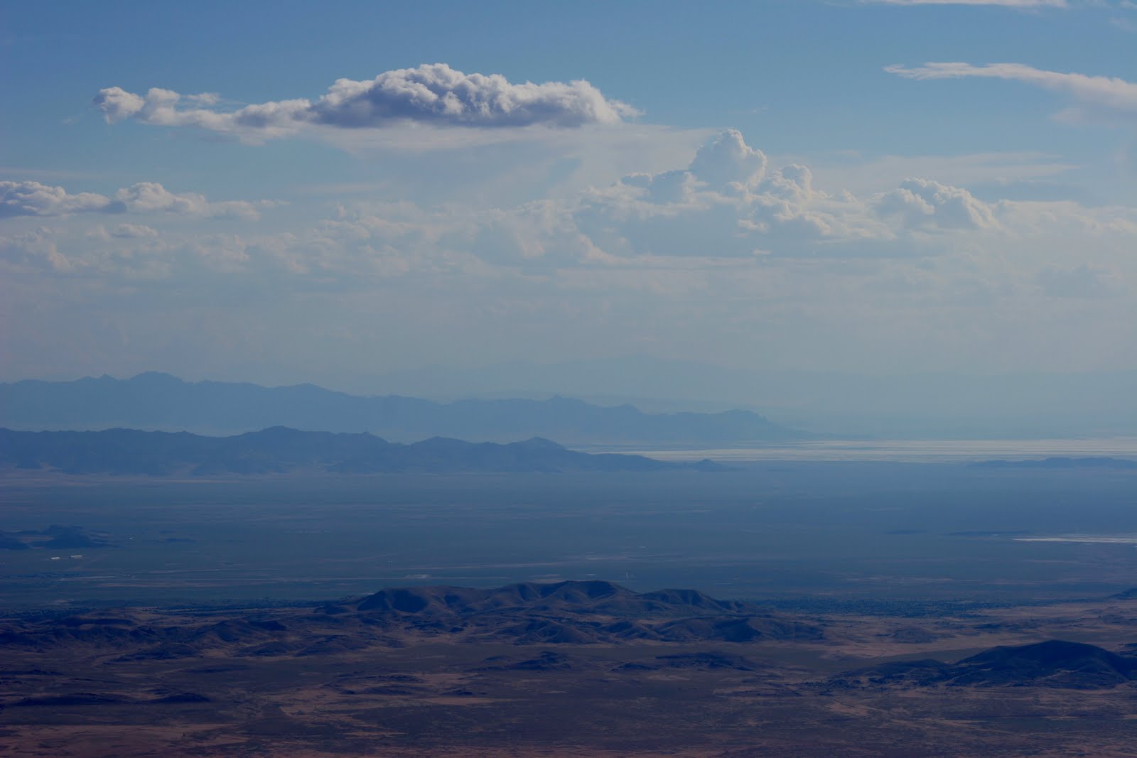
The view from the top of Mt Moriah was spectacular!  I could make out peaks in every direction that were between 80 and 130 miles away (though faint on the longer distances).  Peaks visible were Pilot Peak to the north, Deseret Peak to the NE, Mount Nebo to the E/NE, Notch Peak in the House Range to the east, Indian Peak to the SE, Wheeler Peak to the South (of course) the Egan Range and Schell Creek Range to the SW & West, Spruce Mountain to the NW.

Another view of Wheeler Peak to the south:

On the way back down, looking north.  The northern part of the Snake Range is more arid, looking north toward the Deep Creek Mountains:
Heading back down the western slope, looking at Spring Valley to the west.  (Spring Valley is one of the valleys the Las Vegas water authorities are trying to acquire for a pipeline to Sin City.  Think Spring Valley already looks pretty dry?  Me, too.)


Last few moments of daylight:

Sunday, August 28, 2011

Raftriver Mountains, NW Utah

In the northwest corner of Utah, north of the Great Salt Lake, is an east-west range called the Raftriver mountains.  It's a unique part of Utah, because the northern slope of this range drains into the Snake River, which joins the Columbia River, and empties into the Pacific Ocean.  The southern slope of the Raftriver range produces several creeks, which empty into the Great Salt Lake, or otherwise dry up in the desert.
I approached this range from the north, traveling west of Snowville, UT about 35 miles, and then south and up into the Raftrivers.  Since my VW Jetta is not a great offroad vehicle, *wink*, to get to the top of this range I ended up hiking about 5 miles each way on established 4WD/ATV trails, gaining about 2500 feet in elevation.  It was worth it.

The northern slope of the Raftrivers has an impressive amount of conifer forests:


Looking NW into Idaho to an area called the City of Rocks, which is a popular location for rock climbers:
Looking north from the top ridge, toward a lower ridge, with Idaho in the background:
The top of the Raftrivers is about 9900 feet, but it is essentially an east-west ridgeline that is several miles long.  There was still some snow north of the highpoint in late August.

Looking just about directly south, to the Newfoundland Mountains, which is a north-south range about 50 miles away.  The Newfoundlands are pretty remote, with Desert Peak topping the range at about 7500 feet. 

To the southwest about 60 miles or so is Pilot Peak, NV, a landmark that you can see from numerous locations along the Wasatch and other Great Basin ranges in Utah & Nevada:

Southeast from the summit in the distance you can see the Wasatch at Willard, UT with Willard Peak on the left & Ben Lomond Peak to the right.  The Promontory Mountains are in the foreground, along with the northern tip of the Great Salt Lake:

Looking south down one of the short canyons that are north of the community of Park Valley, UT, the Hogup Mountains west of the Great Salt Lake are in the background:

Sunday, August 14, 2011

Deseret Peak

Deseret Peak is the highpoint in the Stansbury Mountains, which is the 2nd range west of Salt Lake going into the Great Basin.  Beautiful landscape, the top portion carved out by a glacier, with the Tooele Valley basin on the east, and Skull Valley just to the west, with the arid and lower Cedar Mountains beyond that, and the Great Salt Lake desert and salt flats beyond that.


I have to get a wildflower picture in here.  There are a ton of wildflowers this year, especially at higher elevations.


Plenty of stands of Aspen:


Looking back to the NE down South Willow Canyon, with the southern part of the Great Salt Lake and Antelope Island in the distance, as well as the Oquirrh Mountains on the right, and then Bountiful Peak and Francis Peak of the Wasatch in the distance:


Across the Tooele Valley to the northern portion of the Oquirrh Mountains, with the Davis Country portion of the Wasatch behind them:


It was about 3700 feet of vertical, reaching 11,031 at the peak, where the view was impressive.  I wish the day was a little clearer, but I could make out Mount Moriah in Nevada, about 115 miles to the southwest, as well as Gunsight Peak to the north, near Idaho, past Ben Lomond Peak and the Wellsville Mountains.  Pilot Peak in Nevada was fairly easily seen, across the salt flats and playa of the Great Salt Lake Desert, and I was able to see the Toano Mountains west of Pilot Peak, as well as the Goshute Mountains and Antelope Mountains in Nevada.  On a clearer day I'm pretty sure you could see Wheeler Peak at Great Basin National Park, which would be about 135 miles away.

Looking southwest, the south end of the Cedar Mountains, then Granite Mountain in the US Army Dugway Proving Ground, with the Deep Creek Mountains in the distance.


Still looking southwest, you can see the Fish Springs Range, and very faint, in the distance is Mt. Moriah.


Looking south, the Sheeprock Mountains are in the background, with the Canyon Mountains east of Delta, UT in the distance.


Looking east, over the top of Lowe Peak and Flat Top Peak at the top of the Oquirrh Mountains, you can see Mount Timpanogos in the background, which overlooks Provo, UT.


Sunday, August 7, 2011

Ben Lomond Peak, Northern Wasatch

Ben Lomond Peak is just north of Ogden, UT, rising to 9712 feet, some 5000+ feet above the valley floor.  I went on a late Sunday hike, starting at 4p, getting back home about midnight. 

The wild flowers were varied and abundant:


Approaching Ben Lomond from the northwest:

Looking south from the top toward Ogden:


Golden eagle riding the air currents below the summit, with North Ogden neighorhood in the background:


One of many Rocky Mountain Goats who were cautiously observant of the intruder with the camera:


It was a hazy day, probably from wildfires somewhere in the West.  But still you could see to Nevada.  Promontory Mountains, then Desert Peak from the Newfoundland Mountains, and Pilot Peak, NV in the distance, over 120 miles away.


Nightime falling on Ogden - gonna be a dark hike back down the mountain!

Lights of Salt Lake appearing in the distance, looking south:


Sunset, over the Raft River mountains to the north west, with the Promontory mountains in the foreground.