Friday, November 29, 2013

About the Author

If you happen to see me out in the Great Basin, this what I look like:


Sunday, October 6, 2013

Deepcreek Mountains, Utah

About 60 miles south of Wendover is a beautiful range of 12,000 peaks, alpine meadows and streams with Lake Bonneville Cutthroat Trout.  (These fish have been in these creeks for 10,000-12,000 years, since Lake Bonneville, because the creeks now flow out into the desert and dry up - there is no connected waterway for the fish to traverse elsewhere.  They've managed to survive out here for many millennia, disconnected from everything else.)

I've been the Deepcreeks before, and most of the canyons and creeks are on the east side of the range, so this time I decided to look at the range from the west, which is adjacent to the Goshute Indian Reservation at Ibapah, Utah, right next to Nevada.  The Ibapah Valley is actually pretty prosperous, with more than a few ranches and farms, even an airstrip right in Ibapah.

There was a dusting of snow on Haystack Peak, with Ibapah Peak on the right, but you can see the west side of the Deepcreeks has pretty short canyons:

 
Plenty of granite in the Deepcreeks, but from this side, I think you may need to get permission from the Goshute tribe to access these rocks:


Plenty of pine, stands of aspen, and 12,000 peaks above the timber line, with snow:
 
Then, I went west into Nevada, into Antelope Valley, where at sunset I could see Mount Moriah, the northern part of the Snake Range (which includes Wheeler Peak and Great Basin National Park):
 
 
I drove east through Pleasant Valley, back into Utah and went north from Partoun, past Trout Creek, close to Callao to find a spot on the foothills to settle in for the night, in the back of Taco.  It was pretty nippy, and with summer gone, the night was long, but there were a billion stars to see, and the Milky Way stood out.
 
This is what Haystack Peak and Ibapah Peak look like from the foothills on the east side of the Deepcreeks:
 

From the remote farming / ranching community of Callao, the Deepcreeks offer some impressive cliffs.

No trip to the Deepcreeks from Wendover would be complete without a trip by what's level of the tiny mining community at Gold Hill:


The selection of merchandise for sale at Gold Hill is what you might call "limited".  You'll need to drive 40 miles north to Wendover if you want to do any kind of real shopping:


Sunday, September 29, 2013

Pancake Range, Nevada

As I was driving from Ely to Tonopah, to hike the Alta Toquima range, it was definitely a monsoon weather flow, which means moisture, which means thunderstorms in the Great Basin.

Just driving along Route 6, a few photographs jumped into my camera.  :)


Sunday, September 1, 2013

Alta Toquima Wilderness, Nevada

At least once a summer I try to make a trip deep into Nevada, and the Alta Toquima has been on my mind for a few years. 

This range is noteworthy for a lot of reasons, namely 12,000+ peaks, a large plateau at the top, and stunning visibility, as well as an archeological site discovered in the early 1980s at the 11,000 level, thought to be about 1500 years old, likely built and inhabited by Shoshone peoples.

Here's an article that compares the Alta Toquima archeology site with a similar site in Wyoming, also near 11,000 feet elevation. Native American High Altitude Living

I've read that when the visibility is crystal clear, you can see both California and Utah from the top of Mount Jefferson.  Unfortunately, on my trip it was a monsoonal weather flow, and there were subsequently plenty of clouds, thunderstorms, but like is common in the desert, not much actual rain.

I went north of the surreal town of Tonopah, past some kind of annual gathering of interested parties at the restored mining town of Belmont, and started up a canyon on the SE edge of the Alta Toquima range, ending up at the mouth of a short but steep canyon right next to the Mount Jefferson South Summit called Andrews Creek.

The view down Andrews Creek canyon, looking east toward the Monitor Range:


Once on top of the Alta Toquima mesa, the terrain was windswept, with lots of thunder in the distance, in pretty much every direction.  A small herd of Bighorn Sheep occupy Mount Jefferson:

I hiked north on the plateau, which has beautiful overlooks of the Pine Creek canyon area on the east side of the range, into Monitor Valley.  Finally the sun broke out and some photos were to be had:


I don't know exactly where the archeology site is in this range, but at the top of Pine Creek canyon there was a mountain lake, and it's not hard to imagine Shoshone inhabiting this area in the summer as a seasonal hunting area:


A trail of cains to mark the trail on top of the mesa, looking east:

 
Driving back to SLC the next morning, I saw a couple of Golden Eagles at different points:


Sunday, July 28, 2013

Goshute Mountains, NE Nevada

Just SW of Wendover is a north-south range about 25 miles long, one of many, many such ranges in Nevada. 

The Goshute range is probably most famous (recently) for being the location where volunteers from Hawkwatch International assemble in the late summer / early fall to count raptors flying south for the winter.  Because of the Great Salt Lake Desert, ranges like the Goshutes provide a great location to spot birds of prey migrating, because the raptors will funnel into routes that provide opportunities to find food, they "surf" from range to range, on their trip south into Mexico and Central America.

During the summer monsoon season in Utah - which really means, just more humid air from the Pacific ocean that results in clouds and some thunderstorms, not the drenching rainstorms like they have in Asia - I took my trusty Toyota out to the Goshutes and then climbed the 1500 vertical feet to the top.  As always, a trip very worth the gas money, time, and wear & tear on my hiking boots.

Speaking of raptors, here's a Golden Eagle perched on a rock before I started up into the Goshute range:


Maybe not a full drenching, but plenty of Great Basin monsoon precipitation, which might mean some drizzle, but could also mean "dry lightning", which can start a range fire and move on, not helping to put out the fire with significant amounts of rain.  (Looking north in the Goshutes on the way up):


Once up on top, I saw the Hawkwatch camp location and the sun broke out, with some nice vistas as a result.  Here's a pine tree near the top that's seen better days, perhaps a victim of lightning: 


Looking south from the Goshute Peak summit, some pine forests, a small section of Antelope Valley, and the south end of the Goshutes in the distance:


Looking SE from the summit, with Dutch Mountain at the very north end of the Deepcreek Mountains in the distance:


Looking NE, with a nice little mountain meadow in the foreground, and Pilot Peak, NV on the left, Wendover and the western edge of the GSL desert in the middle, and the Silver Island mountains in the distance in center and toward the right:


Looking north, Pilot Peak looks like a volcano:


"Taco", my trusty Toyota Tacoma, is a little speck, even with 300mm of lens:


Another shot of Pilot Peak on the way out:


Saturday, June 1, 2013

Grouse Creek Mountains, NW Utah

West-Northwest of the Great Salt Lake about 80 miles are the Grouse Creek Mountains, which run north & south about 25 miles.  They top out around 9000 feet and don't have a lot of foliage, but there is some.  The view from the top of the Grouse Creeks is, not surprisingly, pretty nice.  (This is a recurring theme in my trips to the desert.:) )

From near the top of Inghram Peak, looking SE with the Newfoundland Mountains in the distance:


Near the top of Inghram Peak, there are lots & lots of these little circular cacti, at about the 8500-9000 foot level.  I'm not an expert in cactus, but I thought they were pretty cool:


Benchmark, Inghram Peak, but with no elevation stamped:
 
 
Looking south from the summit, with Pilot Peak on the right, and the Silver Island Mountains distance in the middle.


Looking NE, the Raftriver Mountains run East-West, about 20 miles away:


There are some stands of pine in some of the west-facing canyons, and a few small creeks that supply the small community of Grouse Creek, Utah with water:


As sunset gets closer, some better lighting emerges.  Looking SE toward Desert Peak and the Newfoundland Mountains:


Sunday, April 14, 2013

Cedar Mountains Wilderness, Utah

About an hour west of SLC on I-80, past Grantsville, past Skull Valley, lies the Cedar Mountains, which form the last range going west before the expanse of the Great Salt Lake Desert.  The Cedar Mountains are quite arid, and remarkably undisturbed.  If you want solitude, they are an awesome resource, and it's heartening to know this range was designated as wilderness.


Yep, the ill-fated Donner Party went through this range on their
way to California, before getting really bogged down in the
salt flats trying to get to Pilot Peak, the nearest fresh water on
an 80 sprint across the GSL desert.


Looking SW toward the Deep Creek mountains, and the
Snake Valley, currently a controversial issue because
Las Vegas wants to take their already meager water supplies.


Looking NW toward the Newfoundland Mountains and Desert Peak.


From the top of the Cedar Mountains, looking east to Deseret Peak
 in the Stansbury Mountains.  See all that snow? 
That's why I'm not hiking the big peaks quite yet.  lol.


On the way to the summit.  Pretty easy hiking, a good workout at 7000+ feet.


The day was mostly cloudy, windy and cold, with a cold front dropping
the temperature about 20F during my hike, but the sun broke out
later to give me some nice shadow effects against the sparsely forested foothills.


Almost sunset, back down on the road on the west side of the range
some Cedar trees provide a nice foreground to their namesake mountain range.


A couple of Ferruginous Hawks trying to stay out the wind.


Cedar trees lined up in a row at sunset.


Saturday, April 6, 2013

Newfoundland Mountains, NW Utah

The Great Salt Lake desert is an expansive flat area of playa, mudflats, salt flats.  In the middle of this vast, uninhabited area is a small ranges called the Newfoundland Mountains.  This range is very isolated, though the hike to the top of Desert Peak is rewarding.

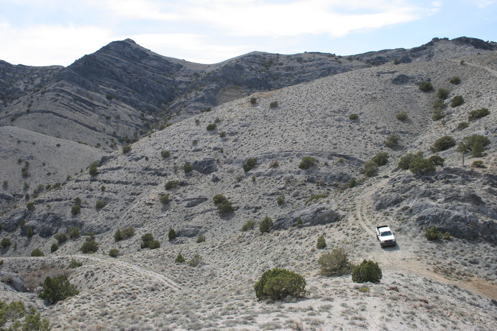
Crossing the railroad from Lakeside (about 25 miles of gravel
road, max speed about 35mph) you travel south and to hike
Desert Peak I went along the western "shore" of this range to
an old mining trail, and got up as high on the bench as I could.
Along the south ride of Desert Peak, looking
south along the eastern side of the range as it
extends like the tail of a scorpion.


Another shot looking south from Desert Peak


Looking north from Desert Peak.  There were rain squalls moving
through, and three prarie falcons above making a lot of racket.


Coming back down, as the day turned to dusk,
a view to the W-SW with Silver Island Mountains and
Pilot Peak behind.


Looking north down the western side of
the Newfoundlands, with the Grouse
Creek Mountains in the distance.


Last few moments of sunlight, looking toward
NW corner of Newfoundlands from mudflats.