I recently flew to Phoenix to watch a football game and catch up with a former colleague, but took indirect flights, on purpose, wanting to see if I could get some good photos from the plane with my Nokia 1020 phone-camera.
Basically, I went from SLC to Denver, to Phoenix, to San Franciso, and back to SLC
The first leg was from Salt Lake to Denver, with a departure out over the Great Salt Lake.
As we got closer to Denver, some nice shots appeared out my window, so I had no choice but to click the button!
Out of Denver to Phoenix, I found a nice shot of Great Sand Dunes National Park, with the Sangre de Cristo Mountains adjacent.
Approaching Phoenix, Camelback Mountain, surrounded by city:
Of course, I had to hike Camelback, which is an excellent workout, no chance for hypothermia!
The football game was great, and then my journey was from Phoenix to San Francisco:
Enroute to San Francisco, Yosemite National Park appeared:
From San Francisco, headed east, Lake Tahoe, from the SE at 36,000 feet:

A nameless range in the Great Basin:

"Homeward Bound":

Basically, I went from SLC to Denver, to Phoenix, to San Franciso, and back to SLC
The first leg was from Salt Lake to Denver, with a departure out over the Great Salt Lake.
 |
| Above the Great Salt Lake on a NW departure, looking southwest, with Stansbury Island on the right, the southwest corner of the GSL in the foreground, the Stansbury Mountains and 12,000 Deseret Peak to the left, the Cedar Mountains further back, and the Deepcreek Mountains in the distance, over 100 miles away |
As we got closer to Denver, some nice shots appeared out my window, so I had no choice but to click the button!
 |
| Looking North on a range in Colorado, with the high plains of Wyoming in the distance |
Out of Denver to Phoenix, I found a nice shot of Great Sand Dunes National Park, with the Sangre de Cristo Mountains adjacent.
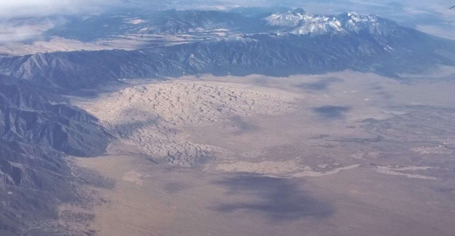 |
| Great Sand Dunes + Sangre de Cristo Mountains |
Approaching Phoenix, Camelback Mountain, surrounded by city:
 |
| On approach to PHX, Camelback Mountain from the air |
Of course, I had to hike Camelback, which is an excellent workout, no chance for hypothermia!
 |
| Echo Canyon, on the way up Camelback |
 |
| Iconic Saguaro Cactus |
The football game was great, and then my journey was from Phoenix to San Francisco:
 |
| Downtown Phoenix on departure |
Enroute to San Francisco, Yosemite National Park appeared:
 |
| Yosemite from above, after an early autumn snow |
From San Francisco, headed east, Lake Tahoe, from the SE at 36,000 feet:
A nameless range in the Great Basin:
"Homeward Bound":


